Maps from Google Maps and all images from Street View.
101.4 km - 62.5 km = 38.9 km (banked)
Note: This was a particularly mountainous ride. Now that I am in Italy, Google Maps no longer provides bicycle routes, so some of this ride is unrealistically on motorways. I'll have to map out walking routes from this point on to be more realistic.
1. Rue Vernier, Nice
2. Avenue Raymond Comboul, Nice
3. The M5007, Nice
4. Boulevard de Suede, Beaulieu-sur-Mer
5. Plage Petite Afrique, Beaulieu-sur-Mer
6. Basse Corniche, Beaulieu-sur-Mer
7. Avenue du Trois Septembre, Cap D'Ail
8. Prince's Palace, Monaco
9. Boulevard Albert 1st, Monaco
10. Monte Carlo Casino, Monaco
11. Avenue de General de Gaulle, Beausoleil
12. Avenue Agerbol, Roquerbrune-Cap-Martin
13. The E74, having crossed into Italy
14. Latte, Liguria
15. One of the tunnels of the E74
16. Statue of Spring, Sanremo
17. Via Aurelia, Sanremo
18. Hotel Riviera, my virtual stay in Sanremo
19. Porto Vecchio, Sanremo
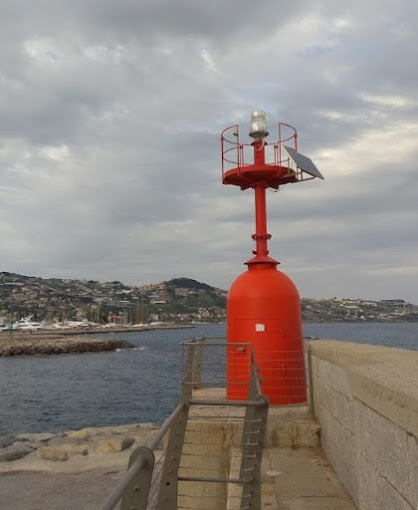
20 Lighthouse, Port of Sanremo
21. Villa del Sole, Sanremo
22. Santuario della Madonna della Costa, Sanremo
23. Inside the Santuario
24. Statua di Mike Bongiorno, Sanremo
25. Forte di Santa Tecla, Sanremo


