Wednesday, April 29, 2020

The (Virtual) Peripatetic Pensioner - Stage 13 of the Tour de Rellies - Ironbridge to Shardlow

Maps from Google Maps and all images from Street View.

Banked distance  136.8 km/85.1 mi   -   110.4 km/68.6 mi  = 24.6 km/ 15.3 mi.


1.  Bridge over the River Severn, Ironbridge


2.  Jackfield Tile Museum, Church Road


3.  Sign for the Severn Valley Way Bicycle Route 


4.  Coalport Road over the Severn River


5.  Haven Hills area


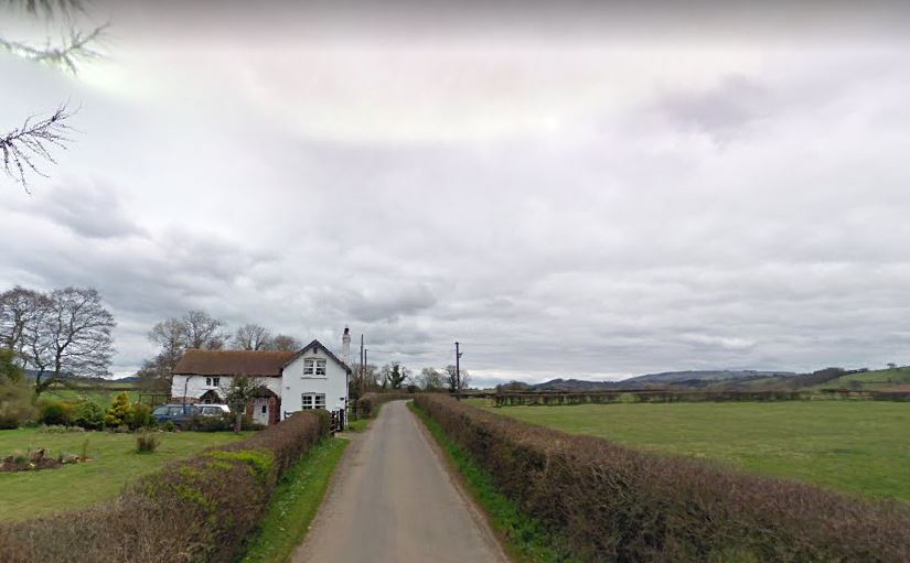
6.   Caynton Cottages, Caynton


7.  Shrewsbury Arms Pub, Albrighton


8.  Tow path, Dunstall Park, Clareton


9.  Tow path, Wolverhampton


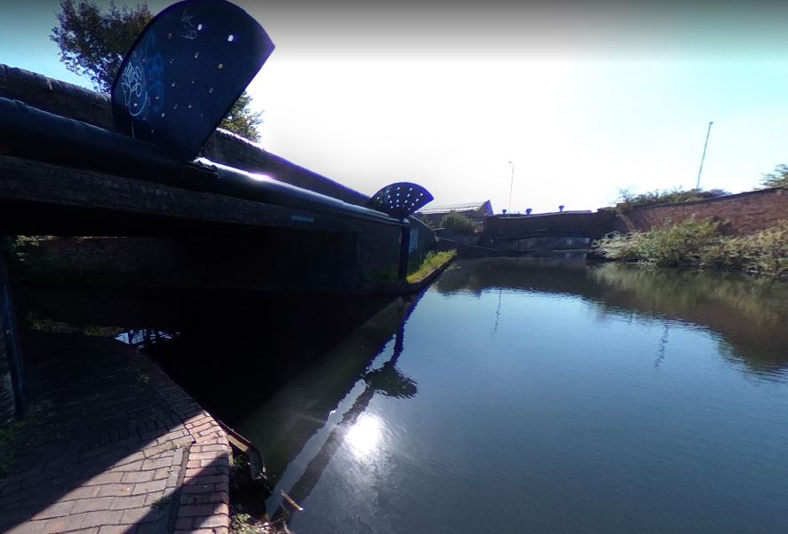
10.  Canal Locks, Wolverhampton


11.  More canal locks, Wolverhampton


12.  Canal tow path, Wolverhampton


13. Another tow path view, Wolverhampton


14.  Miner's Statue, Brownhills


15.  The A5 (Watling Street - originally a Roman road)


16.  Christ Church, Lichfield


17.  Lichfield Cathedral


18.  Netherstowe bicycle path, Lichfield


19.  Tow path at Fradley Pool, Burton on Trent


20.  The Green Man and Rising Sun pubs, Willington


21.    Bicycle path at Infinity Park Way, Derby


22.  Bicycle Path at Sinfin Moor Lane, Derby


23.  Navigation Inn pub, Shardlow


24.  Marina Bar at the Shardlow Marina and Caravan Park


25.  The Emily May is out there somewhere in the marina


26.  Jon, the Emily May and the pooches


Tuesday, April 28, 2020

The (Virtual) Peripatetic Pensioner - Stage 12 - Ludlow to Ironbridge

Maps from Google Maps and all images from Street View.

Banked distance 146.5 km./91 mi. (Banked) -  41.7 km/25.9 mi. = 104.8 km/65.1 mi (banked)


The Bull Ring Tavern, Ludlow


2.  St. Laurence's Church, Ludlow


3.  The B4361 Ludlow


4.  St. Leonard's Church Gateway,  the church now houses a print-shop


5.  Fishmore Road at Carpenter's Lane


6.  Just north of Great Sutton


7.  Peaton


8.   North of Peaton


9.  Broncroft Castle, on Sandy Lane, Tugford


10.  The Feathers Pub at Brockton


11.  Stile and sign before Much Wenlock


12.  Gaskell Arms Pub, Much Wenlock


13.  Slight detour onto the High Street, Much Wenlock


14.  Whitmore Street and Much Wenlock Parish Church


15.   Wharfage, Ironbridge


16.  The Museum of the Gorge, Ironbridge


17.  The Iron Bridge, Ironbridge


18.  Bedlam Furnaces, Ironbridge


19.  Bird in Hand 1774 Inn, Ironbridge  -  my (virtual) stop in Ironbridge


Saturday, April 25, 2020

The (Virtual) Peripatetic Pensioner - Stage 11 from Builth Wells to Ludlow

Maps from Google Maps and all images from Street View.

Banked distance 147.6 km/91.8 mi.  -  64.1 km/39.8 mi.  =   83.5 km./51.9 mi. (Banked)


1.  Hign Street, Builth Wells.


2.  Turning onto Station Road, Builth Wells


3.  Crossing the River Wye, Builth Wells


4.   Turning onto the A481


5.  Along the A481


6.  Sheep beside the A481


7.  The Hundred House Inn


8.  Along the A481


9.  The A44 at Llanfihangel


10.  Red Lion Inn at Llanfihangel


11.  New Radnor


12.  East of Beggar's Bush


13.  Offa's Dyke Path


14.  Warden Road


15.  Presteigne, Wales


16.  Ongar Street


17.  St. Giles Church, Killhorse Lane


18.  Ludlow Castle, from Whitcliffe Road, Ludlow


19.  Whitcliffe Road, Ludlow


20.  Charlton Arms Pub on the A4361, Ludlow


21.  The Wheatsheaf Inn on St. John's Road, Ludlow


22.  Bull Ring, Ludlow


23.  The Feathers Hotel (my virtual stay in Ludlow)


24.  Heading down King Street, en-route to Ludlow Castle


25.  The entrance to Ludlow Castle


25.  Ludlow Castle from Above