Maps from Google Maps and all images from Street View.
61.2 km/38 mi. - 47.8 km/29.7 mi. = 13.4 km/8.3 mi. (banked)
In know Rebecca (my niece) is near Totnes, but I don't have an exact address, so will aim for a virtual hotel in town.
1. Topsham Road (A3015), Exeter
2. Bicycle path parallel to the Exeter Ship Canal
3. Church Street, Powerham
4. The Strand, Starcross
5. Port Road
6. Greenway Lane
7. Another view of Greenway Lane
8. Just south of Bishopsleighton
9. Besigheim Way over the River Teign
10. Torquay Road, Newton Abbot
11. St. Mary's Road, Coach Road, Newton Abbot
12. Old Totnes Road, Newton Abbot
13. Bow Street, Ippelpen
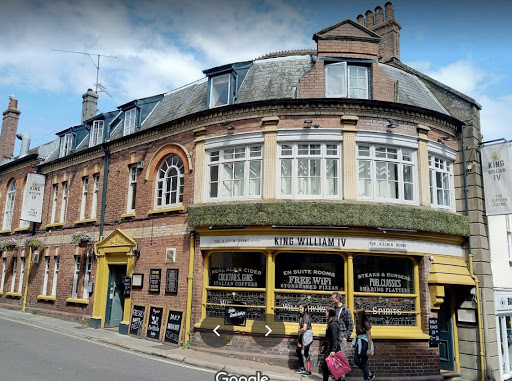
14. King William IV Hotel and pub, my virtual stay in Totnes
15. Fore Street, with the Totnes Museum on the left
16. Inside the Totnes Museum
17. Totnes Castle
18. South Devon Railway, Totnes Littlehempston Station
2. Bicycle path parallel to the Exeter Ship Canal
4. The Strand, Starcross
5. Port Road
6. Greenway Lane
7. Another view of Greenway Lane
8. Just south of Bishopsleighton
9. Besigheim Way over the River Teign
10. Torquay Road, Newton Abbot
11. St. Mary's Road, Coach Road, Newton Abbot
12. Old Totnes Road, Newton Abbot
13. Bow Street, Ippelpen
14. King William IV Hotel and pub, my virtual stay in Totnes
15. Fore Street, with the Totnes Museum on the left
16. Inside the Totnes Museum
17. Totnes Castle
18. South Devon Railway, Totnes Littlehempston Station


