Maps from Google Maps and all images from Street View.
101.4 km/63 mi. - 48/29.8 mi = 53.4 km/33.2 mi. (banked)
1. Lower Lago seascape from Main Street
2. Main Street, Lower Lago
3. Robinson Crusoe Statue, Lower Lago
4. Largo Road
5. Standing Stane Road, (A915)
6. Ravenscraig Castle
7. Ravenscraig Castle
8. A921 west of Kirkcaldy
9. Burntisland Road (A921), Kinghorn
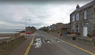
10. Pettycur Road, Kinghorn
11. Pettycur Bay, Kinghorn
12. Oil drilling platform, anchored in Pettycur Bay
13. West Broomhill Road, Burntisland
14. Aberdour Castle
15. St. Bridget's Kirk, Dalgety Bay
16. The B981, Invertheithing
17. Crossing the Firth of Forth Bridge -- the railway bridge is to the left
18. View of the railway bridge from the road bridge viewpoint
19. High Street (B924), Queensferry
20. View of the railway bridge from the B924
21. The Inkeeper's Lodge (Hawes Inn), my virtual stay in Queensferry

Anyone returning to look for teaching resources should look at the archived material from 2017 and earlier. On April 2, 2020 I re-purposed this site to reflect my current interests. At this time I can travel only in the virtual universe because of the Covid-19 pandemic. From Sunday, March 22 I've logged exercise bike and real bike kilometers, applied distances in Google Maps, and am taking a virtual ride to the homes of relatives here, in the UK and in Europe.
Blog Archive
-
▼
2020
(81)
-
▼
June
(12)
- The (Virtual) Peripatetic Pensioner - Stage 35 of ...
- The (virtual) Peripatetic Pensioner - Stage 34 of ...
- The (Virtual) Peripatetic Pensioner - Stage 33 of ...
- The (Virtual) Peripatetic Pensioner - Stage 32 of ...
- The (Virtual) Peripatetic Pensioner - Stage 31 of ...
- The (Virtual) Peirpatetic Pensioner - Stage 30 of ...
- The (Virtual) Peripatetic Pensiioner - Stage 29 of...
- The (Virtual) Peripatetic Pensioner - Stage 28 of ...
- The (Virtual) Peripatetic Pensioner - Stage 27 of ...
- The (Virtual) Peripatetic Pensioner - Stage 26 of ...
- The (Virtual) Peripatetic Pensioner - Stage 25 of ...
- The (Virtual) Peripatetic Pensioner - Stage 24 of ...
-
▼
June
(12)


